
Projects
Experience
Developing a hybrid Graph Search and Reinforcement Learning software for COLREGs-compliant autonomous vessel route planning. Integrating AIS data, maritime traffic rules, and real-time environmental conditions into a unified decision-making framework.
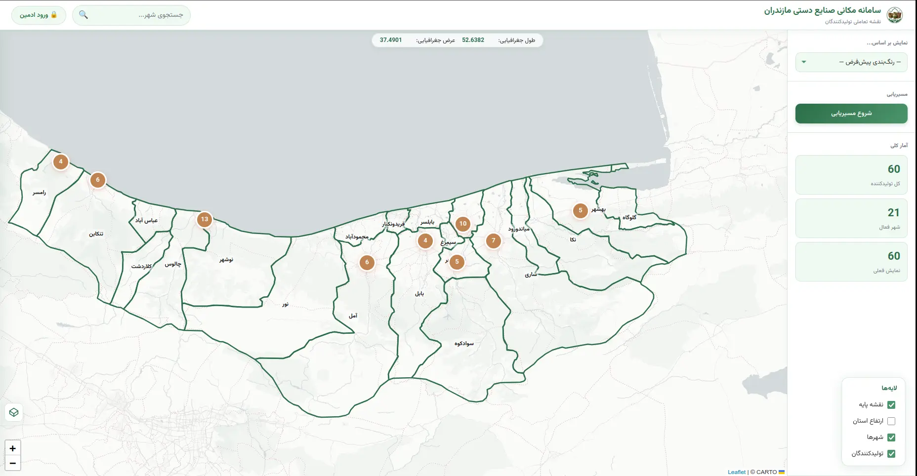
Designed a web-GIS platform mapping handicraft producers in Mazandaran to optimize supply chain visibility. Built with FastAPI, Leaflet, and GeoPandas, integrating terrain, road, and city overlays for logistics and market analysis.
Delivered lab sessions and mentored students in programming and geospatial analysis across multiple courses:
- ✦ GIS Advanced Programming (Master Students)
- ✦ Information Technology in Surveying Engineering
- ✦ Python
- ✦ GIS Operation
- ✦ Quantum GIS
- ✦ DataBase
Taught foundational Python through project-based examples for young learners. Designed engaging, hands-on lessons covering variables, loops, conditionals, functions, and simple game development to build computational thinking skills.
Education
GPA: 3.88/4
Thesis: Spatio-temporal ship trajectory modeling using neural networks and marine environmental data
Supervisors: Hamid Motieyan, Reza Dezvareh
GPA: 3.24/4
Thesis: Examining and modeling the trajectories of moving objects
Supervisor: Hamid Motieyan
Publications
This study introduces a novel FlashAttention Transformer framework for vessel trajectory prediction that integrates domain-specific features including vessel dynamics, environmental conditions (wind, waves, currents, ocean depth), and, for the first time, proximity to fixed maritime structures such as buoys, platforms, and navigational aids. The model achieves significant improvements over state-of-the-art baselines with 55.9% reduction in ADE, 53.6% in FDE, 95.2% in MSE, and 55.9% in MAE, representing an average performance improvement of 65.2%. SHAP analysis identified current speed and proximity to structures as the most influential features in trajectory prediction. The work establishes a new benchmark for real-time maritime trajectory forecasting, with implications for collision avoidance and autonomous vessel operations.
This study examines walkability patterns using pedestrian trajectory data from a central region in Tehran, Iran. The research analyzes relationships between built environment factors and stopping points using both linear and non-linear models, revealing that land use-related factors (entropy, mixed use, accessibility) have more significant effects at mid-range values. Kernel Density Estimation (KDE) and detour ratio analysis are applied to detect attractive areas, identifying that retail stores and eating establishments are strongly associated with pedestrian attractiveness. The study demonstrates that socio-economically developed neighborhoods with moderate UHI levels, adequate park coverage, and diverse land uses encourage longer dwell times. The findings provide actionable guidance for urban planners to develop balanced, pedestrian-friendly neighborhoods.
This research investigates the effect of individual and combined urban land uses on bicycle transportation in Sari, Iran, using trajectory data from WikiLoc and land use data from OpenStreetMap. The study analyzes stop points and detour ratios to identify which land uses most influence cyclist route deviation. Results show that service and welfare land uses (especially cafes) have the most significant individual impact on cyclist deviation (22.7%), while the combined effect of service/welfare and commercial land uses reaches 73.9%. The Tejen River was found to influence 47% of route deviations. The study provides valuable insights for urban planners to design more efficient cyclist-friendly infrastructure, particularly near service and amenity locations.